Click targets
Paste back whatever each popup gives — formation name, age, and the LEX code if the More Information page shows one. Even the name alone is enough.
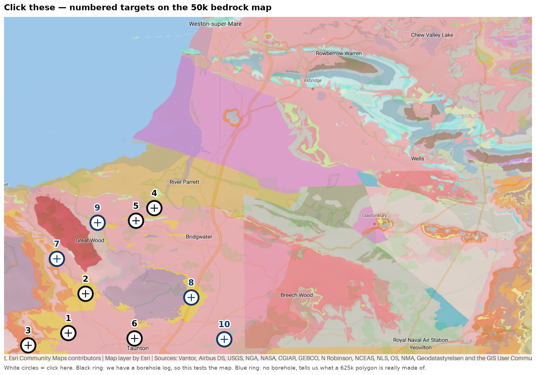
Paste back whatever each popup gives — formation name, age, and the LEX code if the More Information page shows one. Even the name alone is enough.
| # | type | what we already know | why it matters |
|---|---|---|---|
| 1 | borehole | ST12NE6 |
Shepherd Water - we read Sherwood top at 83 m. Does the 50k also say Helsby Sandstone here? |
| 2 | borehole | ST13SE1 |
Bishops Lydeard - our best log, 83 m of Sherwood under 28.7 m of cover |
| 3 | borehole | ST12NW18 |
Milverton - we read PERMIAN (Exeter Gp). The 625k says Triassic 1A. Which does the 50k say? |
| 4 | borehole | ST24SW1 |
Knap Farm - Carboniferous Limestone at 7.6 m, the Cannington inlier. Should come back Carboniferous. |
| 5 | borehole | ST23NW8 |
Currypool - Devonian at 5.1 m |
| 6 | borehole | ST22NW7 |
deepest cover bound near the store - still in Mercia Mudstone at 78 m |
| 7 | polygon | poly 8110 |
inside the 22 km2 625k ‘Triassic 1A’ polygon, no borehole here - what is it actually made of? |
| 8 | polygon | poly 7391 |
inside the 12 km2 625k ‘Triassic 1A’ polygon, no borehole here - what is it actually made of? |
| 9 | polygon | poly 5543 |
inside the 3 km2 625k ‘Triassic 1A’ polygon, no borehole here - what is it actually made of? |
| 10 | polygon | poly 5085 |
inside the 3 km2 625k ‘Triassic 1A’ polygon, no borehole here - what is it actually made of? |
Not markable on this screenshot
- The modelled store (E330255 N122245) sits just below the bottom edge. Needs a small pan south — and it is the single most worthwhile click of the lot, because nothing has ever been drilled deep enough there.
ST32SW1(E330580 N124310) — outside the frameST01SE18(E306830 N112820) — outside the frame