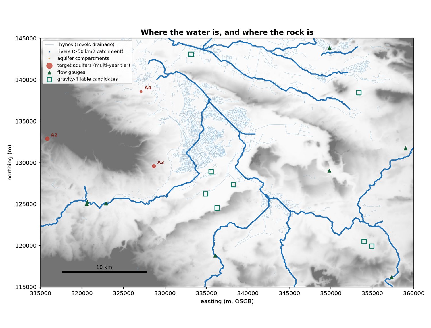
 Banking winter water for a dry summerSomerset has too much water in February and not enough in July. Can the surplus be caught and kept — in a reservoir, underground, or both — and given back when it is needed?
Aquifer Storage
Catching winter flood water and keeping it underground until summer — worked through on open data, for the Somerset Levels.
The report · version 2, August 2026
Banking winter water for a dry summer
Eight options for catching the winter surplus and giving it back in July, tested against a six-year drought. Twenty-five figures, every number traceable to the chapter it came from.
Somerset has too much water in February and not enough in July. This project asks whether the surplus can be caught and kept — in a reservoir, underground, or both — and returned when it is needed.
The report above is the way in: written for a general reader, with every number linked to the background chapter it comes from. Those chapters sit behind it rather than alongside it — they are working documents, and there are about forty-five of them. The versions that came before it are kept too, at the bottom of this page, because the corrections between them are part of the record.
No option here has been costed. Nothing in this project is a recommendation.
Latest
Banking winter water for a dry summerSomerset has too much water in February and not enough in July. Can the surplus be caught and kept — in a reservoir, underground, or both — and given back when it is needed?
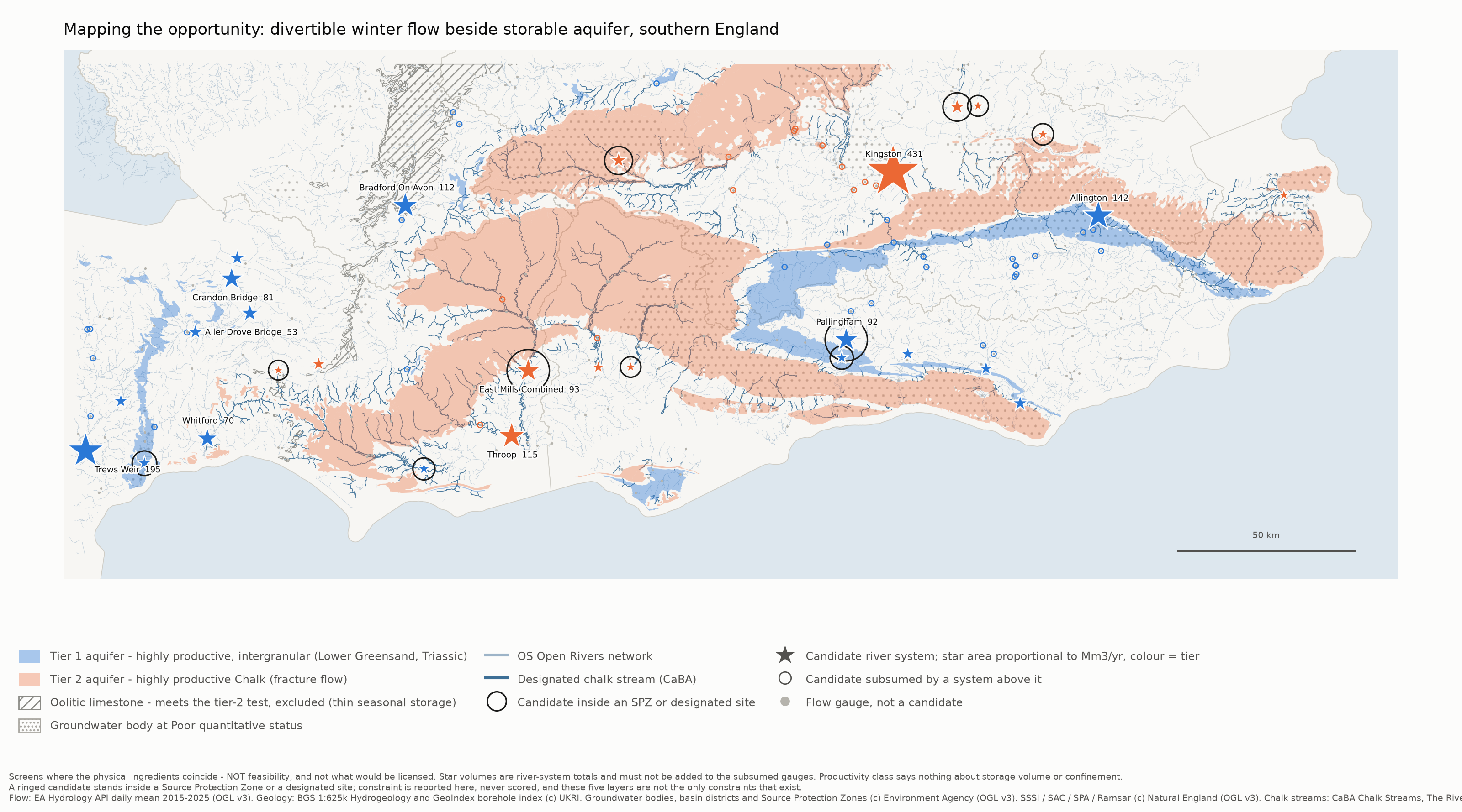 Mapping the opportunity — how it was builtMethod, reliability and findings behind the southern England screen
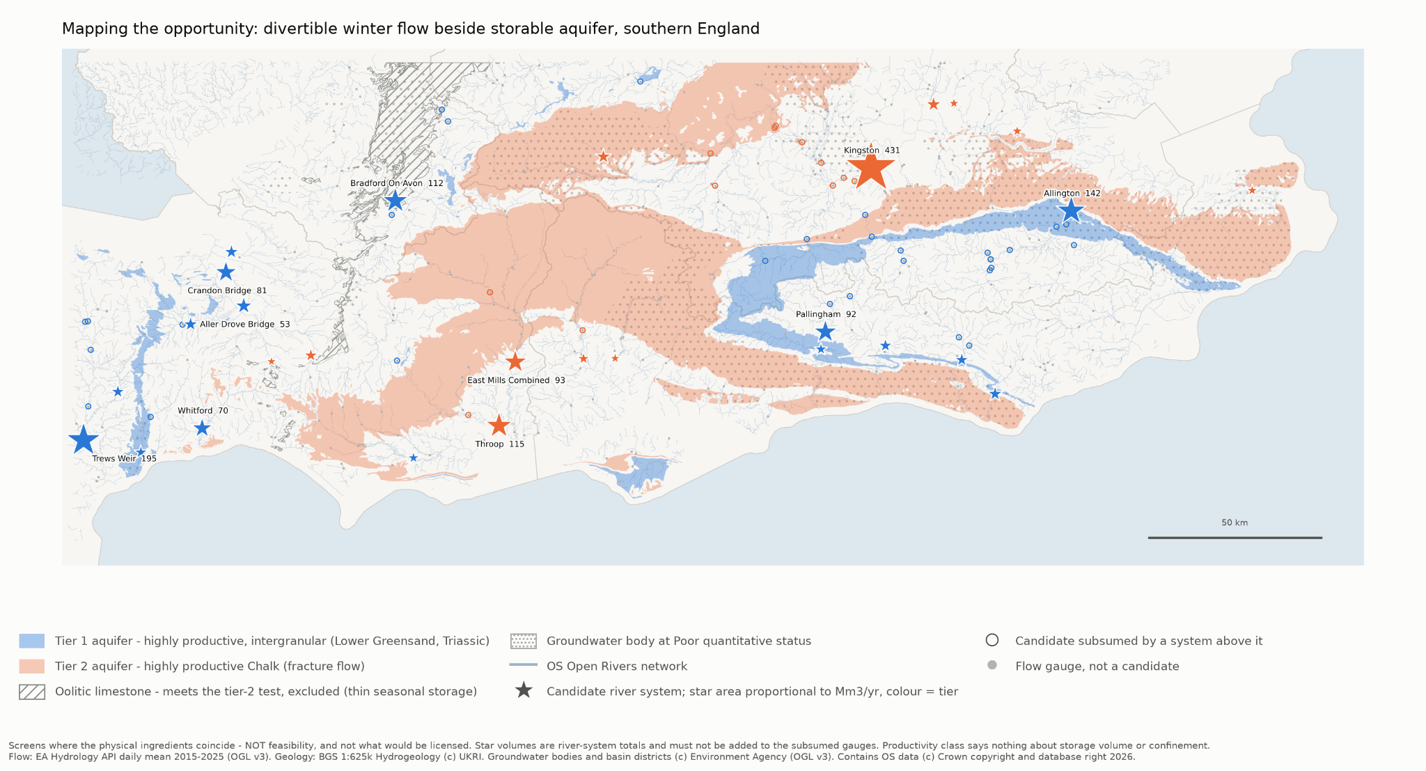 Mapping the opportunityA first-pass screen for seasonal aquifer storage in southern England
The report
Mapping the opportunity
Mapping the opportunity — how it was builtMethod, reliability and findings behind the southern England screen
Mapping the opportunityA first-pass screen for seasonal aquifer storage in southern England