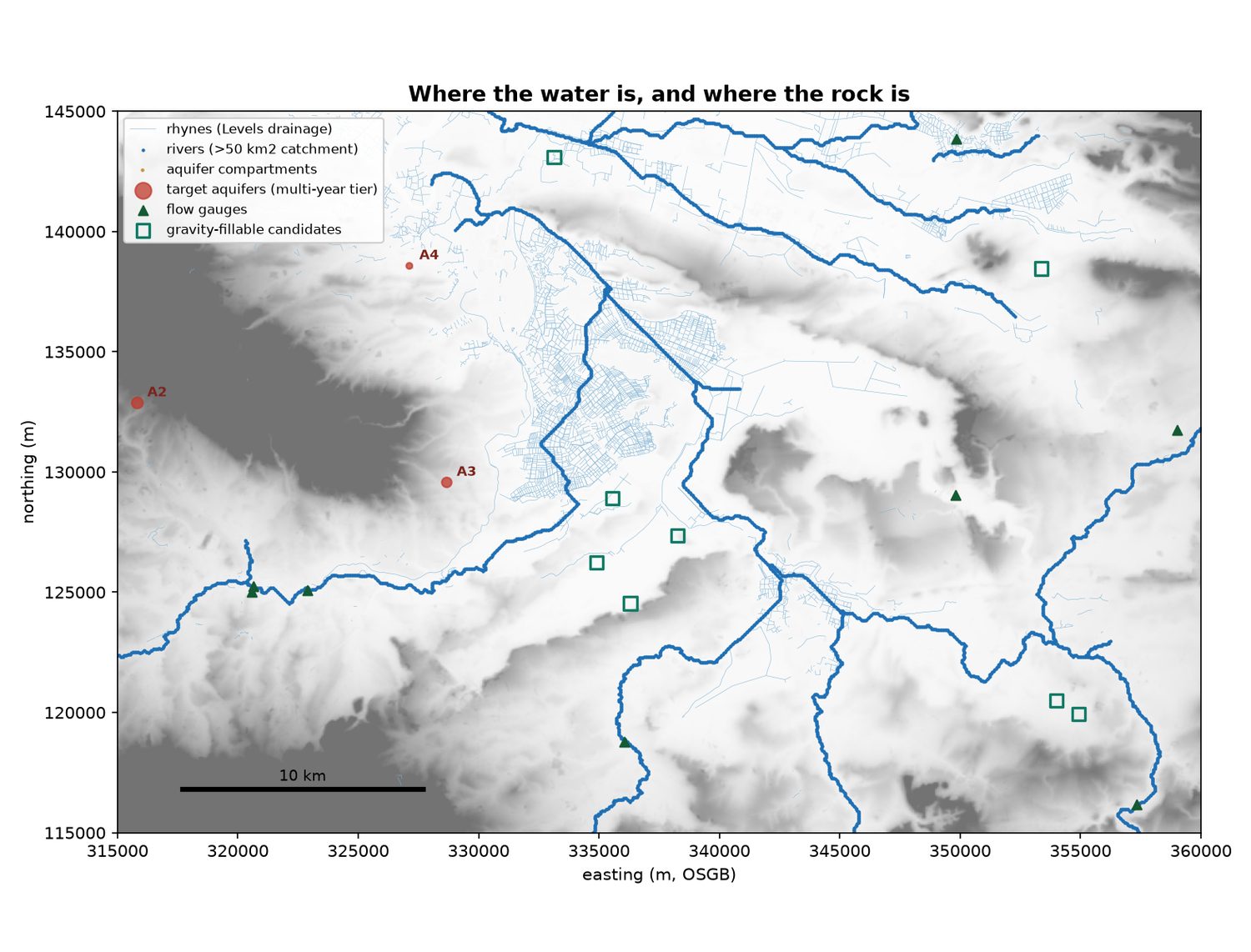
 Banking winter water for a dry summerSomerset has too much water in February and not enough in July. Can the surplus be caught and kept — in a reservoir, underground, or both — and given back when it is needed?
Modelling
Working a catchment out from open data — rainfall, rivers, the ground underneath — and asking what could be done with it.
The umbrella over the water work. Each project underneath is a question asked of a real place, answered with data anyone can download: what falls, where it goes, what the ground will hold, and what a scheme built on those numbers would actually deliver.
Aquifer Storage is the first and largest of them — the Somerset Levels, worked from rainfall through to three costed-out-in-volume scheme options.
TODO: what else belongs here. River routing and catchment work that is not specific to the Somerset question would sit alongside it rather than inside it.
Latest
Banking winter water for a dry summerSomerset has too much water in February and not enough in July. Can the surplus be caught and kept — in a reservoir, underground, or both — and given back when it is needed?
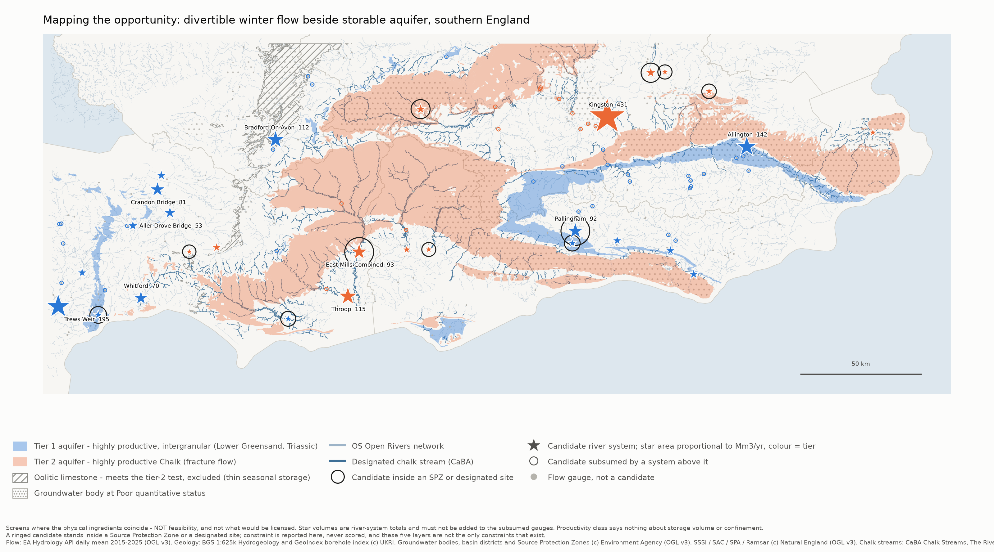 Mapping the opportunity — how it was builtMethod, reliability and findings behind the southern England screen
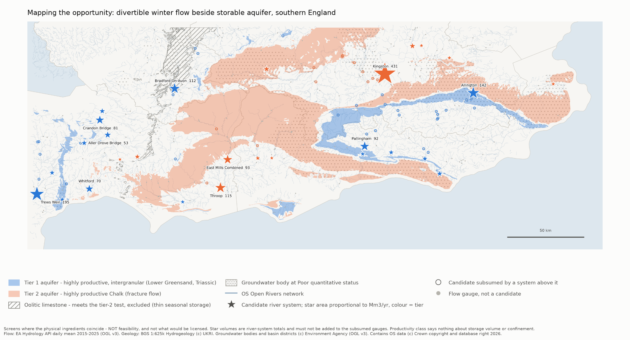 Mapping the opportunityA first-pass screen for seasonal aquifer storage in southern England
Aquifer Storage
Banking winter water for a dry summerSomerset has too much water in February and not enough in July. Can the surplus be caught and kept — in a reservoir, underground, or both — and given back when it is needed?
Mapping the opportunity — how it was builtMethod, reliability and findings behind the southern England screen
Mapping the opportunityA first-pass screen for seasonal aquifer storage in southern England